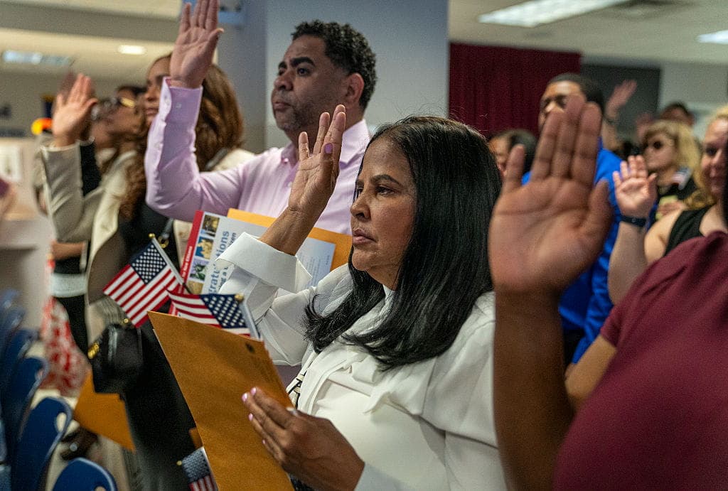
Folks talking about wanting their states to secede is nothing new. Over the past few decades, however, more areas are looking toward secession. The political divide and the parties’ reluctance to work together seem to be the driving forces. The draconian measures some politicians enforced during the COVID pandemic, the fight over sex education for children, the left’s open border policies, and dissatisfaction with local, state, and federal government officials have added to the desire for redder or bluer pastures.
The state boundaries were all drawn long ago, but so much about the US has changed. The Mises Institute argues that the idea those old lines represent the "correct" border "should be regarded as absurd and obsolete." So what are some of the more recent efforts?
States Trying to Secede – Recently
California
Golden State residents have launched several campaigns to either secede from the Union or split into multiple states. In 2016, activists tried to push a six-way split. In 2018, a proposal to chop it into three new states received enough signatures, but the Supreme Court of California pulled the measure from the ballot for "further constitutional review." Then there's the Calexit movement, which aims to make California a sovereign republic outside the United States. Though obviously unsuccessful thus far, it seems to pop back up every couple of years or so. A proposal was recently approved in San Bernadino County to study secession as a first step in separation. The great political divide drives efforts to secede, with the coastal areas wanting to remain progressive while the agricultural Central Valley leans more Conservative.
Colorado
Eleven rural counties in the Centennial State wanted to break away in 2013 and become the 51st state. In 2021, Weld County proposed joining Wyoming because its local politicians were not supportive of small business, agriculture, or oil and gas.
Illinois
John Jackson of Southern Illinois University Carbondale said he has been hearing about secession since 1972, but that the conversation has changed. Some efforts to secede started in 2019, and currently, three counties, including Madison, have voted to “explore” the idea. Jackson claimed Madison County used to be a Democratic Party stronghold. “We have flip-flopped on party identification in this area,” he told NPR. “Southern Illinois has followed the American South in its march from Democratic to Republican.”
Oregon/Idaho
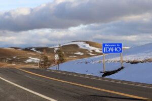
(Photo by: Don and Melinda Crawford/UCG/Universal Images Group via Getty Images)
The Greater Idaho movement is an ongoing attempt for Oregonians who want to leave the Beaver State and join their redder neighbors in Idaho. Twelve counties in Oregon have voted to pursue relocation of the state border.
In 2021, referencing a protest at Capitol Hill in Idaho, state Rep. Barbara Ehardt, a Republican, told Desert News:
“In our constitutional republic, you cannot just set up a CHOP zone. If you cannot seek redress of your government that is in your state because they’re adhering to a lawless form of government, then I believe you have every right to seek redress with the next closest government. In this case, it would be the state of Idaho.”
Besides the legalities of trying to secede from one state to join another, there are other issues that make doing so difficult, if not impossible. In California, the proposal to divide the state into three separate entities could see a myriad of issues. The Central Valley is mostly agricultural, and it's where the coast gets a lot of its produce. If the proposal were to be approved, the coast would have to import goods from the Central Valley.
In the Greater Idaho proposal, Oregonians included in the secession could see lower wages, less federal funding, and even higher poverty levels. Guian McKee, associate professor in Presidential Studies at the Miller Center at the University of Virginia, told Desert News that redrawing borders won’t solve the political problems. “I think it’s actually a rejection of some core democratic principles” and he suggested “we’ve lost some of the ability to disagree. That’s really dangerous, I think, for democratic life.”
How States Got Their Borders
In Mark Stein’s book, How the States Got Their Shapes, he said the important influences that determined their shapes were “the American Revolution, the construction of railroads, the proposal for the Erie Canal, and the issue of slavery.”
Thomas Jefferson did not like how the 13 colonies varied in size and shape and wanted a more equal distribution based on latitude and longitude coordinates. But as time went on and territories became states, the way the borders were defined was sometimes as simple as just drawing a line. As the Mises Institute explained:
“For example, when Colorado residents sought to form a separate territory—which would later become a state—the mapmakers more or less just drew a big trapezoid around the Denver area. Much of the boundary between California and Nevada is similarly arbitrary. And, of course, the state lines that are also international borders—such as the border between Arizona and Mexico—is simply the product of a treaty born out the US's brutal war of conquest against the Mexicans.”
For decades, these lines worked because much of the Western US had small populations usually driven by agriculture. “Moreover, small populations often tend to have less diversity, and when Colorado was added to the Union in 1876—for instance—it had fewer than 150,000 people. When Idaho became a state in 1890, it has fewer than 90,000 people. California, when it became a state, had fewer than 100,000 people spread over 163,000 square miles,” the Mises Institute explained. The twentieth century changed this as the country became more populated and diverse and the interests of the communities varied.
Factors vs Population – The Politics That Changed the Dynamics
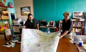
(Photo by Nick de la Torre/Houston Chronicle via Getty Images)
Our legislative districts weren't always based on population as they are now. “[A]t least one house in many state legislatures were apportioned based on territory or factors other than population. Most states apportioned representatives based on population in their houses of representatives, but in the state senates, representation was often apportioned regionally. This was recognized as a means of providing an electoral counterbalance to highly populated urban areas within the state,” the Mises Institute wrote. “The goal was to provide a means for populations outside the urban centers to veto especially objectionable legislation at the state capital.” But in 1964, in Reynolds v. Sims, this changed so that all legislatures had to have a “one-man-one-vote principal. This means all legislative districts within the states have to be roughly the same size in terms of population. This has turned the state senates into nothing other than smaller versions of each state’s house of representatives.”
Since that ruling, rural areas don’t have as much say in what happens to their area. “This has accelerated conflict between state metros and the periphery in each state,” the Mises Institute said. Furthermore:
“Unless state governments are willing to press the issue in federal courts of returning to representation based on factors other than population, the only reasonable solution is to redraw state boundaries to better reflect demographic and ideological realities.”
From Calexit to the Greater Idaho movement, it seems that the dividing line between these states' populations is political. When Joe Biden spoke of his "unity" agenda as a presidential candidate, he made assurances that the divided nation would come together once more. Yet, as with most political promises, those words soon faded away after the election. State boundaries appear but a symptom of dissatisfaction that is unlikely to be resolved by the redrawing of lines on a map.
*CORRECTION: In an earlier version of this article we wrote that 11 counties in Oregon had voted to pursue relocation of the state border; the actual number is twelve. Thanks to Chris of the Greater Idaho Movement for providing us with the correct details.